
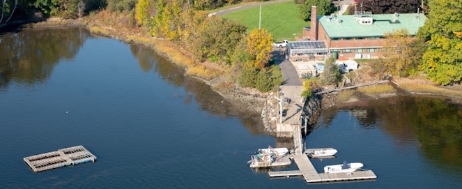
Jackson Estuarine Laboratory
Creative Commons License

This work is licensed under a Creative Commons Attribution 4.0 International License.
Abstract
The present impacts from coastal storms and high tides grow significantly over time due to SLR even over the relatively short period to 2060. Hydrodynamic model simulations of storm surge with and without sea level rise scenarios show that although flooding and inundation increases with increasing subtidal forcing and higher sea level, dissipation of the tide and storm surge in the estuary channel somewhat limits the maximum inundation that might otherwise be expected in the back marsh areas. The estuary is dominated by high marsh, which lies high in the intertidal zone and by 2060 it will convert to mostly low marsh unless it can build very rapidly (greater than 5 mm/year). The marsh supports fisheries and many charismatic birds, some marsh dependent, and provides a culturally significant view-scape across the estuary. The Sea Level Affecting Marsh Model (SLAMM) was used to predict habitat changes due to 0.73 m SLR by 2060 under different accretion rates and levels of protection for developed areas that became intertidal. Although the relative amounts of high marsh and low marsh varied dramatically, the overall marsh area remained within 5% of the current levels and mostly increased if marsh accretion rates exceeded 2 mm/year. Limited areas of intertidal flats supporting shellfish exist in present day, but in the near future culturally important recreational shellfish areas will convert to open water. However, areas that are currently low marsh will drown and may provide future shellfish areas. The open water harbor is important for boating, access to coastal waters and recreational fishing. Currently, the open water area is small, but may double in size by 2060 and the greater tides relative to the marsh elevation will create a different feel for the estuarine landscape in the future because high tides will regularly cover larger areas of the marsh with seawater.
Outside of the estuary on the oceanfront, beaches and dunes support tourism and intensive recreational use as well as federally protected nesting shorebirds (piping plover, least tern). Most of the outer beach is exposed to Gulf of Maine waters. Where there are existing floodwalls, rising sea levels will worsen the storm danger and damage to the integrity of the walls. Unless walls are raised, storms will also transport massive amounts of beach sediments over the walls and across the barrier system. Beaches will have less width and steep ramping to the walls will severely decrease the value of the beach for tourism. In areas with dune systems, very little change is predicted for this area because the dynamic equilibria of the dune-beach system will allow the beach to build in elevation as sea level rises and wind-driven dune building will continue. Bedrock outcrops (at Plaice Cove, Great Boars Head and the inlet) help reduce landward erosion.
The socio-economic impacts result in more people flooded as sea level rises, particularly of socially vulnerable populations, and more anchor institutions flooded. Residents presently living in the most socially vulnerable census blocks were 8.6 times more likely to be located in the flood zone, compared to those living in blocks with low social vulnerability. Under climate change,census blocks with high percentages of the population living in poverty were 17.7 times more likely to be located in the flood zone. This analysis more likely reflects the winter/spring population than the summer population. The estimated annual expected value damages in the present are approximately $0.90 M. In 2060 with SLR they are $4.8 M. Using a 7 % discount rate, the present expected value of these damages between 2018 and 2060 is approximately $27 M. There are many sources of possible error in this value due to missing data, and not including damages to infrastructure, human mortality and morbidity, lost business (particularly recreation), and other cascading and multiplier events. We also do not include the value of ecosystem services.
The adaptation goal focused on protecting the socio-economic systems of the barrier beach areas. Engineering approaches that only use hard structures or grey solutions may weigh the communities down with severe debt, result in long term damage to the environment and degrade the charm and attractiveness of the area to tourists. On the other hand, allowing over-wash and marsh migration everywhere will reduce the number of people and tourists that benefit from the beaches and dunes, shellfish flats, marinas, fishing and marshes. Because marshes of limited area do not significantly decrease storm surge and there is limited wave activity on the western, inland side of the barrier beaches, the marshes may not directly contribute to reducing the flooding on the western side of the barrier beaches. Regional solutions such as building a berm or a floodwall (smaller footprint limits direct marsh losses) to limit land loss will prevent marsh migration. Flood protection berms to protect all residential development bordering the estuary will result in significant marsh loss. Individual site flood management actions such elevating buildings must be employed there.
The most expensive adaptations are needed on the coastal side where the beach-dune system has been replaced by an armored shoreline (seawalls) designed for pedestrians and automobiles, but not beach goers. These walls need to be fortified; their expansion opens an opportunity to provide alternate transportation pathways that are safe (bike lane), green space, and a more attractive promenade (increasing ecosystem/cultural services for residents and visitors). The beaches need to be nourished to provide sandy areas at high tide (especially in the northern areas) to better support the tourism industry. The two oceanfront sections without walls or dune systems were especially vulnerable; these could benefit from green adaptation solutions that construct and maintain sacrificial dunes at relatively low cost. Residential areas landward of existing dune fields were deemed the best protected and only required low cost adaptation decisions (e.g., building sand barriers at beach access cuts and maintaining dune health). Heavily used roads that cross marshes on causeways will need to be raised. Although more expensive, roadways elevated above the marsh surface will reduce impacts from direct filling and provide better tidal exchange. Thus throughout the HSE, there are limited reasonable green options for coastal flood management here.
The present value adaptation costs in 2018 including capital and maintenance costs discounted at 7 % is approximately $149 M. This adaptation cost is more than the previously estimated damage avoided cost or benefit of $27 M. Because, as noted earlier, this benefit estimate is significantly underestimated due to data and methodological limitations, we cannot really state this project is not cost-effective; it actually may be cost effective. A lower discount rate would also increase it cost-effectiveness. Adaptation would mitigate some of the direct impacts to social vulnerable populations, but in some areas would require towns investing in the protection of their individual residents instead of being part of a possibly less costly regional solution. The adaptation plan could provide important public health benefits through the addition of the green elevated walkway (in place of current parkingspaces) along the floodwall.
We met with several local non-governmental (NG) and mixed governmental and NG organizations over the grant lifetime. They generally support our findings. One possible troubling possibility is that 75% of respondents of one relatively small, but representative, sample agreed that convincing residents to support flood protection measures that may benefit home-owners in the flood zone, at the perceived ‘expense’ of those residents who do not live in the flood zone, is a significant challenge to municipal adaptation planning and emergency preparedness. In response to the statement, “Residents generally would be receptive to implementing the green/gray strategies presented”, 43% disagreed, 14% were neutral, and 43% agreed.
As described above, the marshes themselves are not major contributors to present and future flood protection in the area. They are, of course, valuable for other reasons. Examples include habitat, runoff treatment, recreation, tourism, and carbon storage. An estimate of the annual values of these services in HSE are approximately $370 M under present and future SLR conditions. Thus, their preservation should be a priority.
Department
Natural Resources and the Environment
Publication Date
2018
Document Type
Report
Recommended Citation
Kirshen, P., S. Aytur, D. Burdick, D. Foster, T. Lippmann, E. Douglas, S. Nick, C. Watson. 2018. Integrated Analysis of the Value of Wetland Services in Coastal Adaptation; Methodology and Case Study of Hampton-Seabrook Estuary, New Hampshire. Final Report to NOAA, Award # NA14OAR4310194. 68 pp.
Included in
Community Health Commons, Environmental Engineering Commons, Human Geography Commons, Marine Biology Commons, Oceanography Commons, Other Public Health Commons